RESEARCH GROUP

[Peatlands, ecology, remote sensing, gas fluxes] Naomi currently works on the “Mires Restoration Project”, funded by South West Water. This project aims to understand the effects of moorland restoration on hydrology, water quality, greenhouse gas emissions, biodiversity and agriculture. Her specific interests are greenhouse gas emissions and vegetation change (structure, composition and function).

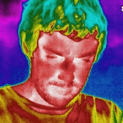
[peatlands, restoration, hydrology remote sensing, thermography] Dave currently works on two projects, the “Mires Restoration Project”, funded by South West Water and a NERC-SWEEP funded project on the theme of water sustainability. On the latter project, Dave is pioneering the use of drone-based thermography for detecting leaks from buried water mains pipes. Underlying the method is a GIS-based method for landscape wetness modeling.

[drylands, carbon, drone-based sensing] Andy is funded by a NERC research grant entitled 'DRIVING-C' where we are seeking to improve empirical understanding of the C cycle in dryland ecosystems. The work seeks to establish a more robust basis for dynamic global vegetation models (DGVMs) that is needed to understand whether global drylands control variability of the land CO2 sink.

[rock glaciers, water supply, remote sensing] Darren is funded by the NERC GW4+ doctoral training funding scheme. He is co-supervised by me and Dr Stephan Harrison (Exeter) and is studying the geomorphic and hydrological characteristics of rock glaciers in the Hindu Kush Himalaya. A key question he is trying to answer is how and why glaciers transition into debris-covered and rock glaciers and what this process means for long-term water security in the Himalayan region.

[vegetation structure and ecosystem function, drone-based methodologies] Dominic is funded by the Marie Curie International Training Network called 'TRuStEE' which is a collaboration between 12 pan-European universities and small businesses. The aim of the TRuStEE network is to capacitate the next generation of scientists to understand and deal with the increasing pressure of environmental change on ecosystem functioning and land-atmosphere interactions.

[ecohydrology, beavers, remote sensing] Hugh is undertaking PhD research funded by the Devon Wildlife Trust. He is investigating the impact of Eurasian beaver reintroduction on the ecology and hydrology of riparian zones. Hugh has undertaken a survey to find evidence for beaver activity in various rivers around Devon. He is now using drone-based structure from motion photogrammetry to monitor the impact of beavers on vegetation in wet woodland areas.

[multi-functional grasslands, ecosystem services, remote sensing] Joel is funded by a joint PhD studentship between the University of Exeter and the James Hutton Institute. He has been developing new ways of improving the spatial assessment of grassland biomass, with a view to improving scientific understanding of the multifunctional services delivered by grasslands.

[coastal environments, seagrass, blue carbon, remote sensing] James is funded by the NERC GW4+ doctoral training funding scheme. He is co-supervised by me Dr Jamie Shutler (Exeter), and Dr Peter Land (Plymouth Marine Laboratory) and is evaluating the role of proximal sensing data for generating new insights into coastal zone processes. A keen ecologist, James is particularly interested in blue carbon and developing new ways to quantify it in coastal zones.

[natural flood management, remote sensing] Nicola's PhD is a collaborative project between the university, Devon Wildlife Trust, the Environment Agency and Natural England. Her work will use spatial data, in situ hydrological and ecological observations and models to determine the impact of natural flood management in Devon's lowland 'Culm' grasslands on catchment hydrological responses.

[image processing, spatial ecology] Leon DeBell is undertaking a maths department-funded PhD at Exeter, exploring the use of intelligent image processing algorithms for automatic feature extraction from drone-based video. Leon will use these algorithms to automatically detect animals in video frames, and potentially to identify the species of animal based on shape- and height-based metrics. The intended application is in population counts of animals in conservation settings.

[remote sensing, geomatics, accuracy, archaeology] Israa has just started her PhD research (Summer 2018) and will be undertaking geomatics-based research that assesses the importance of spatial accuracy on derived products from terrestrial and airborne laser scanning and SfM photogrammetry in archaeological applications.
Past research group members / alumni and where they are now:
-
Dr Jon Bennie, Postdoc (2008-2009) - Lecturer in Biogeography at University of Exeter.
-
Dr Steve Hancock, Postdoc (2014-2015) - Researcher at NASA / Maryland on the GEDI LiDAR project.
-
Dr Antoine Cottin, Postdoc (2013-2014) - Researcher at CarboMap, University of Edinburgh, UK.
-
Dr Stefano Casalegno, Postdoc (2015-2017) – Researcher at Spatial Ecology (self-employed), Italy.
-
Dr Daniel Cox, Postdoc (2013-2017) – Postdoctoral researcher in environmental health, ECEHH, UK.
-
Dr Holly Croft, PhD (2007-2010) – Postdoc at University of Toronto, then ERC Fellow at University of Sheffield UK.
-
Dr Amy Nettley, PhD (2009-2013) – Working outside of academia currently.
-
Dr David Luscombe, PhD (2010-2014) – Postdoctoral researcher in my group researching peatland RS.
-
Dr Sally Rangecroft, PhD (2010-2014) – Postdoctoral researcher at University of Birmingham, UK.
-
Dr Naomi Gatis, PhD (2011-2015) – Postdoctoral researcher in my group researching peatland gas flux.
-
Dr Sasha Kosanic, PhD (2011-2015) – Postdoctoral researcher at Konstanz University, Germany.
-
Dr Andrew Cunliffe, PhD (2013-2017) – Postdoctoral researcher in my group researching dryland C cycles.